WORKING
PACKAGES (WP’s)
The detailed project description is
broken into 9 workpackages (WP’s).
In each of these are presented
the objectives, methodology and the main participants involved.
WP1
(SOIL) DEVELOPMENT OF
HIGH-RESOLUTION GEOPHYSICAL AND HYDROLOGICAL TECHNIQUES FOR MONITORING
WATER CONTENT AND WATER FLOW IN SOILS
WP2
(SAPFLOW) INNOVATIVE
ASPECTS OF SAP FLOW MEASUREMENTS BY HFD METHOD
WP3
(ROOTS/STEM) IMPROVEMENTS
OF NON DESTRUCTIVE TECHNIQUES (NDT) FOR ANALYSING STEM AND ROOT ZONE
STRUCTURE AND WATER CONTENT
WP4
(TREES) INTEGRATED WHOLE
TREES STUDIES: FUNCTIONAL AND ARCHITECTURAL RELATIONSHIPS
WP5
(IRT- REMOTE) SCALING-UP
OF INFRARED THERMOGRAPHY FOR ESTIMATION OF EVAPOTRANSPIRATION
WP6
(FIELD) ESTABLISH
INTEGRATED MULTIDISCIPLINARY FIELD SITES IN PORTUGAL AND ITALY
WP7
(LAND-WATERUSE) USE OF
INTEGRATED MULTIDISCIPLINARY FIELD TRIALS TO STUDY/DESCRIBE PARTIONING
OF WATER FLUXES IN HETEROGENEOUS AGRICULTURAL AND
SEMI-NATURAL LAND USE SYSTEMS
WP8
(MODEL FRAMEWORK)
DEVELOPMENT OF A FRAMEWORK FOR THE MODELLING OF WATER FLUXES IN
HETEROGENEOUS LANDSCAPES
WP9
(USERS) TRANSFER
TECHNOLOGY TO USERS AND PREPARATION OF REPORTS AND PUBLICATIONS
WP1
(SOIL) DEVELOPMENT OF HIGH-RESOLUTION GEOPHYSICAL AND HYDROLOGICAL
TECHNIQUES FOR MONITORING WATER CONTENT AND WATER FLOW IN SOILS
Objectives:
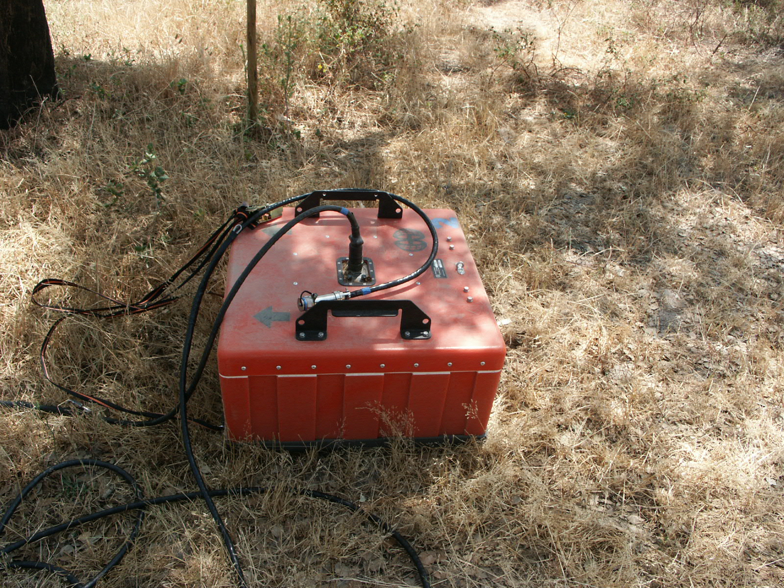
- Construction of a new tank
analog for infiltration studies.
- Development of refined
non-destructive methods using constrained inversion and tomography
techniques of GPR (Ground Penetrating Radar), DC resistivity, and
hydrology data for better
describing structure, water distribution and flow in soils.
Partners involved: CAU and ISA
Methodology:
Justification:
There was a need to develop new
approaches and to
improve the accuracy of existing techniques for monitoring soil
physical properties, soil water content and soil water flows. In
addition to theoretical advances, calibration and testing of new
techniques for data acquisition, processing and interpretation requires
a fully controlled and instrumented physical model system. The
development and testing of new instruments and techniques demands, in
addition to theoretical investigations and field applications,
controlled measurements on a tank analog which simulates the subsurface
geological situation of the problem under study. A first version of a
full scale (open air) model, which is unique in its construction and
functions, was constructed some years ago, but it suffered from some
limitations so there was a need to construct a second, greatly
improved, version. This model could then
be used for infiltration experiments with various boundary conditions
designed for critical testing of the developed arrays and theoretical
techniques and for controlling data quality. Applied methods include
the use of GPR, resistivity, tracers, time domain reflectometry (TDR)
and tensiometer studies. This involved the development of hardware and
software and modelling techniques, concentrating on opportunities for
3-D studies at high resolution. All instrument tests (also for other
working groups, especially 3, 7) have been carried out searching for
the optimum
combination and resolution. We considered the erection
of the tank model to be an essential prerequisite for optimising
instrumentation for the field part of the project. The outcome has been
an enhanced availability of Integrated techniques for
measuring hydrological variables in soils and trunks. Availability of
these integrated techniques allows standardisation and application for
monitoring and controlling sustainable conditions for a wide range of
applications.
Objectives:
- Determine underlying theory of HFD (Heat Field Deformation)
technique and its applications.
- Develop and validate its application to a range of specialize
situations.
- Construct new prototype sensors for wide-scale adoption and
commercialization.
Partners involved: MENDELU
Methodology:
It was proposed to concentrate on
heat
field deformation (HFD) sap-flux technique as recent research has shown
that this has the most potential among those available (Nadezhdina et
al. 1998) for accurately quantifiable measurements of sap-flow and is
applicable to a wide range
of plants from small shrubs to the largest trees, allowing good
replication. This method does not require any calibration and in
addition to measurement of high flows (as do other methods as THB, HD,
HPV), is sensitive enough to measure very low resaturating night flows
(very
important for tree survival) and also reverse flows (e.g. during fog).
HFD-method
allows study of the pattern of sap flow which is a crucial parameter
for
integration of flow from measuring points to whole trees (cross
section) and for
further upscaling to whole stand.
The work involved (a) Evaluation of the theoretical basis of the
technique, (b) Development and validation of the approach in a range of
laboratory and field situations including: treatment of highly
asymmetric crosssections, especially roots, small diameter stems
(branches, roots and shrubs), and measurement and calculation of radial
and vector flows (relevant for water storage and pathway analysis); (c)
Development of methodology of recalculation of sap flow from single
measuring point to the whole tree
using knowledge of radial pattern of flow, important for up-scaling
purposes,
(d) Development of improved software for data manipulation and
visualization of data in 3D and 4D images in case of sap flow
measurements in different xylem depth of tree stems.
Testing has been conducted in the laboratory and in the field close to
participant’s 5 lab. In addition techniques for determining the
necessary biometric parameters (e.g. Cermak 1989; Cermak et al. 1998)
for scaling
up individual tree measurements to stands have been refined (see also
WP3).
The technique and its modifications have been subsequently applied in
the
field in the multiuser experiments and compared against other flow
measurements (link to WP 7).
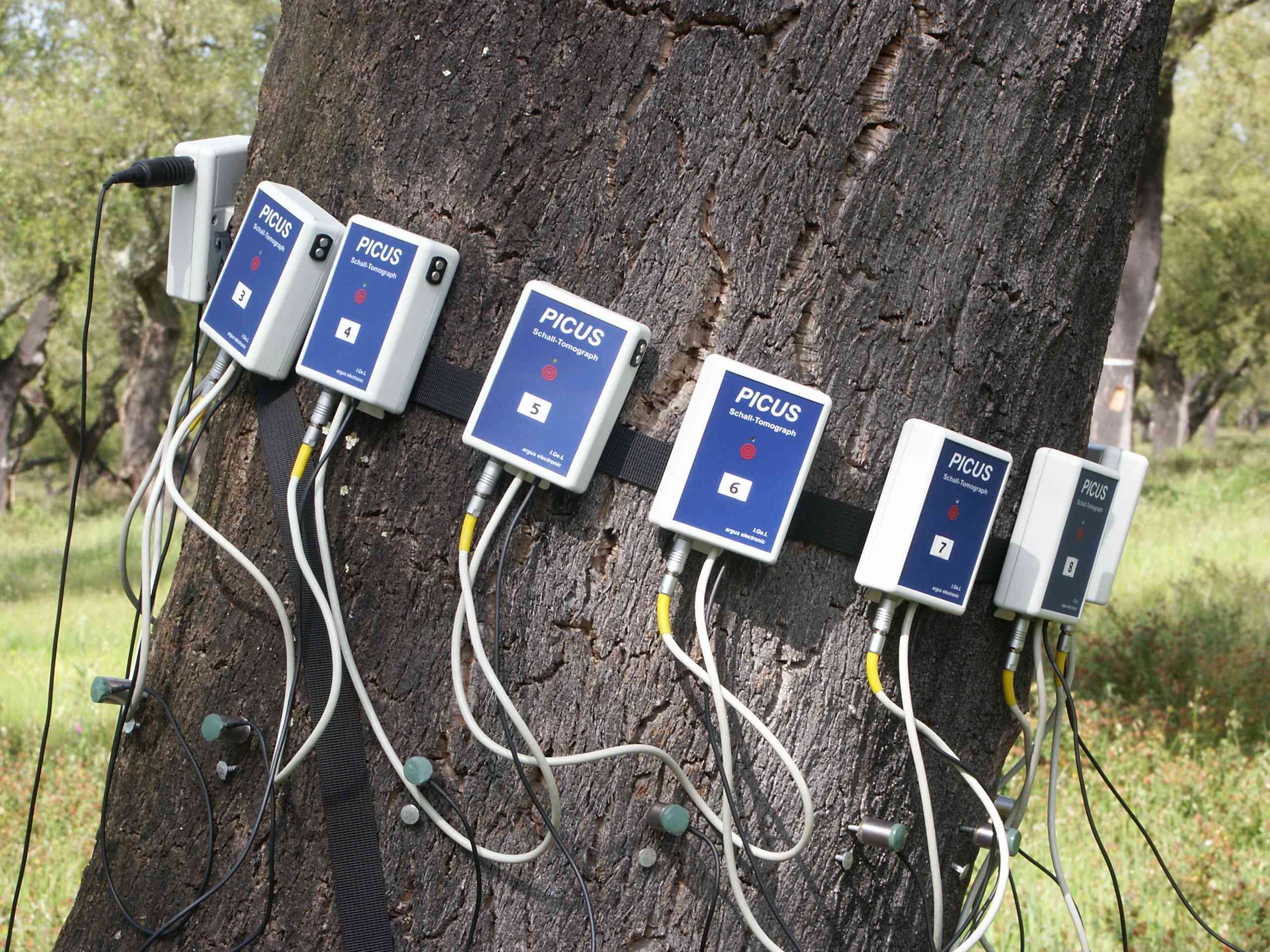
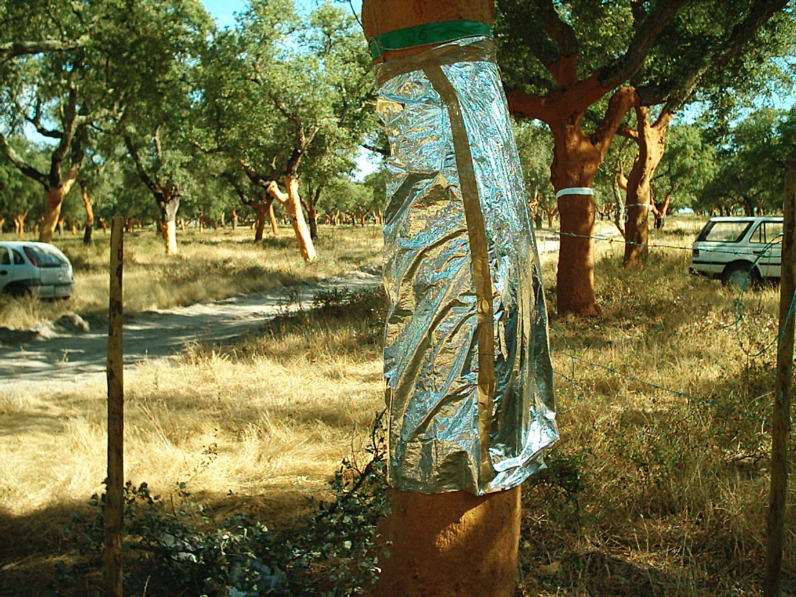
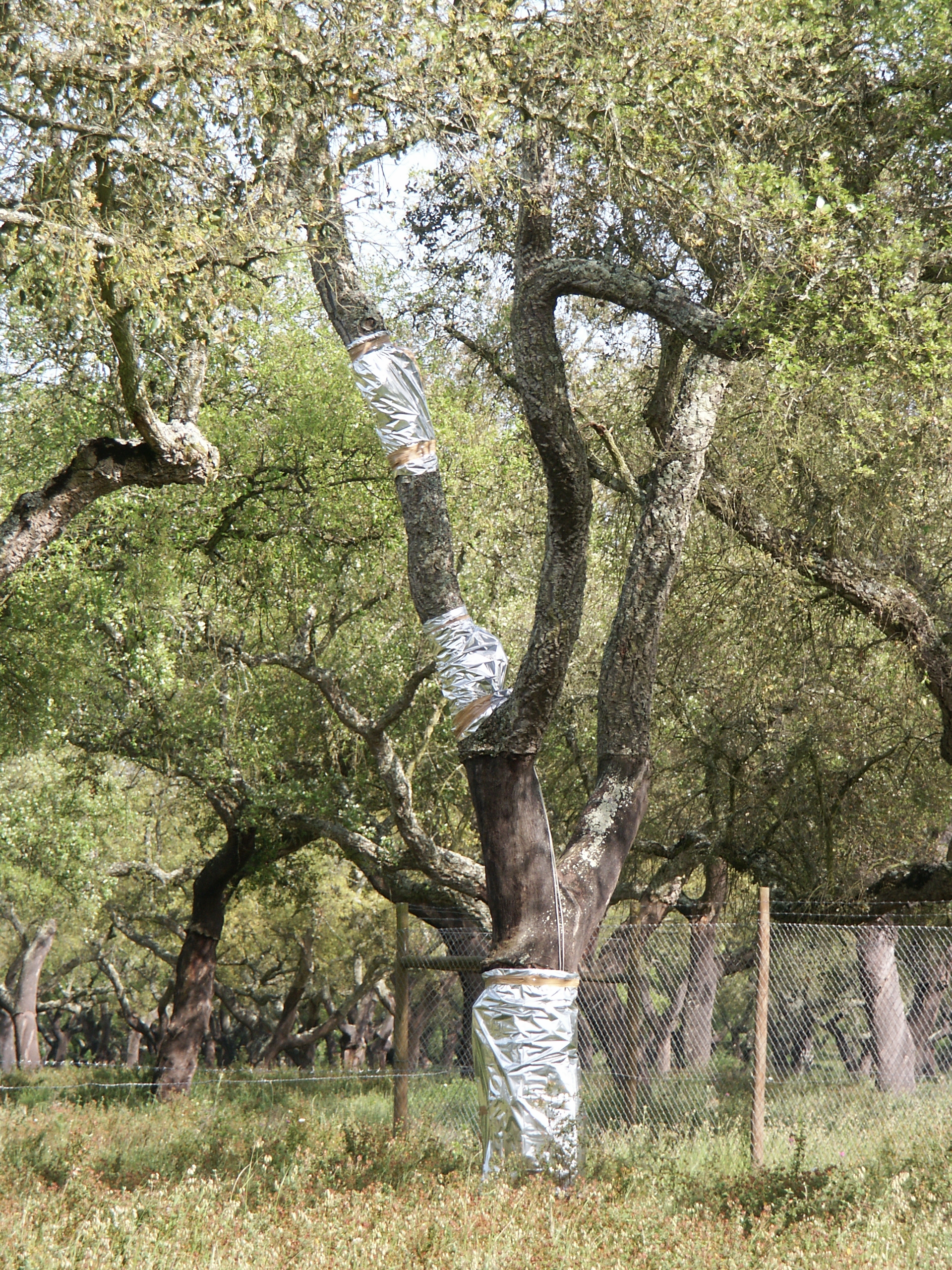
WP3
(ROOTS/STEM) IMPROVEMENTS OF NON DESTRUCTIVE TECHNIQUES (NDT) FOR
ANALYSING STEM AND ROOT ZONE STRUCTURE AND WATER CONTENT
Objectives:
Development, evaluation and selection of most appropriate
highresolution techniques for analysing stem structure, water content
and root structure and distribution for use in the field studies (WP7).
Partners involved: MENDELU, CAU
and GeoHiRes
Methodology:
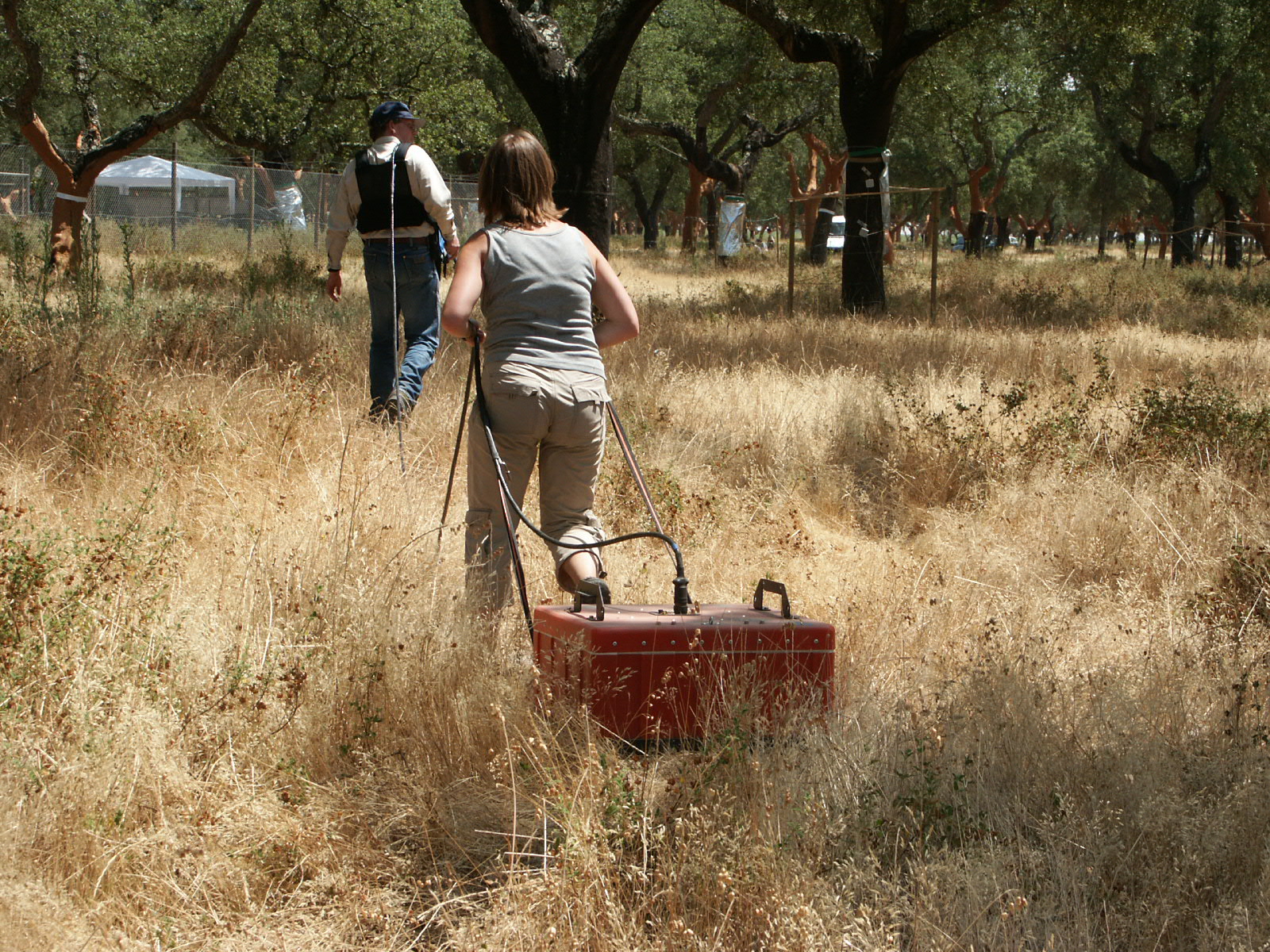
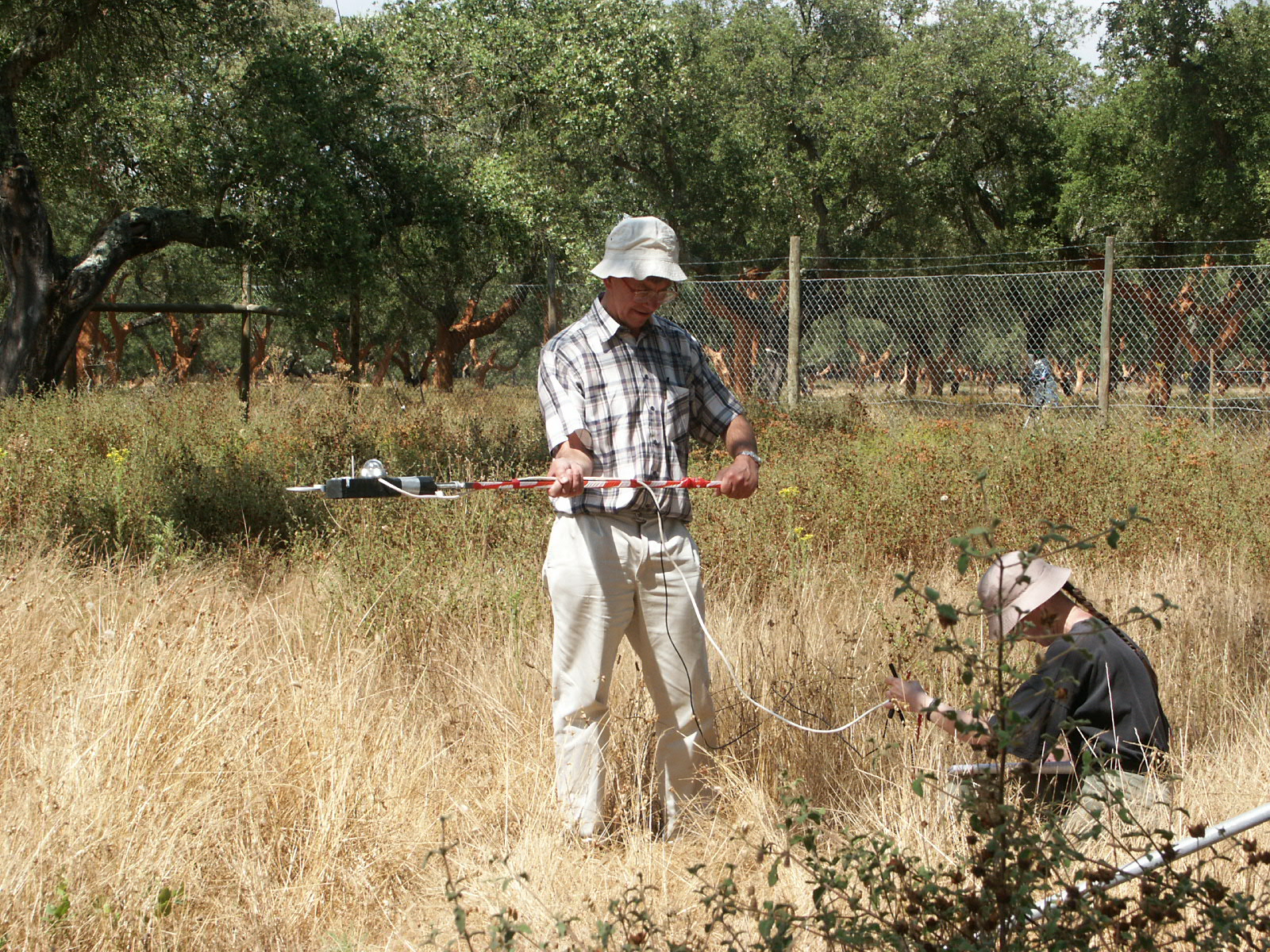
A wide range of techniques have been used, many in the laboratories of
different partners in this project for studying both
wood structure and functionality, and potentially also for studying
root
distribution and water uptake capacity. In order to get the full range
of
information on water flows and water contents in tissues as a
complement to the
sap-flow and transpiration measurements in the field the most
appropriate tools
needed to be selected and then further developed.
Tree stems: Initial work evaluated for present purposes the value
of the following techniques including ground penetrating radar (GPR)
and DC resistivity and especially the potential of using these
tomographically
to determine wood structure (e.g. heartwood-softwood boundary). This
involved the adaptation of inversion and modelling techniques. This
application of these two geophysical techniques has been particularly
novel, but
preliminary trials in one of our labs have shown its feasibility.
In addition a new ultrasonic device for the study of tree stem water
relations has also been evaluated.
Soil: Complementary studies have been
conducted on the use of these techniques for 3-D and 2-D tomography (eg
Hruska et al 1999) of the root zone to identify the root distribution
and its variation in different
tree and shrub systems. For DC-resistivity a new arrangement of
spherical electrodes inserted into the soil using slant boring,
combined with surface
electrodes. For GPR (100 MHz - 1.5 GHz) different tomographic
measurements were carried out along similar linear and circular arrays,
with buried central
electrodes used as reference reflectors, and the orientation of
transmitter and receiver antennae adjusted to optimise resolution
(Daniels and Bower 1998). The
use of bore-hole GPR to aid 3-D structural investigations of the deeper
parts roots zone has been investigated.
The main outcome of this WP was therefore enhanced availability of
advanced techniques for study of water in the root zone and in trunks,
which were used in subsequent parts of the project.
Objectives:
- To provide an integrated picture of water flows in whole plants,
taking account of diurnal flows into and out of storage, radial flows
and the estimation of flows from shallow and deep soil layers and from
different canopy layers.
- Development of techniques to determine the level of drought
stress
as a potential management tool for water resource management, based on
characteristics of day and night flow rate, shape of diurnal curve, and
radial pattern of water flow.
- Develop approaches to scaling-up of sap-flow measurements to
stands.
Participants involved: MENDELU,
ISA and UNPADUI
Methodology:
Techniques to study
water flow and water contents in stems and in the root zone (WP2 and
WP3) need integrating to provide an
accurate picture of the water flow through whole plants and hence to
provide
accurate estimates of actual ET (Evapotranspiration). Particular
problems are
raised by the integration of daily fluxes using sap-flow technology,
because of
the flows into and out of storage and also to the changes in radial
flow. The
integration over 24-h periods has only rarely been attempted so far.
This workpackage therefore brought together studies aimed at describing
the architecture of individual trees (leaf area and disposition, stem
and branch hydraulic architecture, and root distribution) and the
contributions of
flows through each of these segments. Techniques to be combined are
likely to include the integration of sap-flow measurement with
anatomical
description, root and shoot architecture studies [photography, GPR,
root excavation (including the use of the novel ‘air-spade’ technique)
and radiative
transfer analysis).
It has been specified which part of crown (foliage) and root system
(i.e.
soil layer) is connected with certain xylem layer by long-term
measuring sap
flow along xylem radius and carrying out destructive (cutting branches
and
roots) and non-destructive (shading or mist-spraying of specific parts
of
crown, or the use of partial irrigation from different sides of stem
and at
different distances from stem) treatments. Flows have been compared
with
soil water content, branch illumination studies and soil, stem and leaf
water
potentials.
This way it has been also possible to estimate the impact of different
pruning on sap flow
pattern (which could be applied for evaluation of pruning practices).
Integration of information on tree (canopy, stem, root) structure with
corresponding flows allows to estimate absorption of water from
different soil layers, dynamics of this process and importance for tree
survival.
To contribute to the overall objectives of the project, preliminary
development of scaling-up of sap-flow and related tree-level methods to
estimation of stands (Cermak & Kucera 1990; Cermak et al 1998) was
considered (see also WP7).
WP5 (IRT- REMOTE) SCALING-UP OF INFRARED THERMOGRAPHY
FOR ESTIMATION OF
EVAPOTRANSPIRATION
Objectives:
- To develop the theory underlying use of remote estimates of
surface temperature for estimation of evapotranspiration (ET),
especially using ‘internal referencing’.
- Develop methods for estimation of ET from ground-level sensing of
canopy temperature.
- Investigate scaling-up of thermal estimates of ET to the use of
satellite data; compare estimates of ET obtained at different scales
Participants involved: UNIVDUN
and UNPADUI
Methodology:
A key requirement for hydrological
and water balance
studies is the availability of robust and easily applied techniques
that can be
used to estimate evaporation at a range of scales from the individual
plant to
100s of m, through to km.
Many high-resolution techniques are limited in their applicability to
larger scales. The recent innovation of using reference wet and dry
surfaces to enable infra-red measurements of canopy temperature to be
used to
estimate the surface resistance (Jones 1999a) has extended the power of
infra-red techniques. In principle, an extension of this theory can be
used to
estimate evaporation rates (Jones 1999a). The first step has been to
complete the analysis and a sensitivity analysis of its application to
field-collected thermal images has been conducted. Results were
compared with alternative measurements of ET obtained in the field
experiments (WP7, WP8) using small scale techniques and eddy
correlation. The possibility of
extending to the estimation of evaporation using Fuchs’ (1990) method
for infra-red detection of plant stress from the variance of leaf
temperatures has
also been investigated in this phase.
In parallel with the ground-based studies, current approaches to the
estimation of ET from thermal data from satellites were reviewed. A
new approach based on the combination of thermal data with NDVI
(Normalized Difference Vegetation Index) to correct thermal averages
for the
proportion of soil and vegetation in any pixel has been suggested by
Moran and
co-workers (1994, 1996) and the use of within image references (e.g.
water bodies, Jones 1999a) has been developed to estimate ET.
Satellites
were
chosen on the basis of availability of both thermal and red/NIR
channels. High
resolution images (30 m pixels) are available from the Landsat TM but
even in the absence of cloud are at only c.16 day intervals, so these
have been complemented by the more frequent NOAH AVHRR data at lower
resolution (1.1 km). Images were analysed to estimate ET by these
new and by
more conventional algorithms, for the experimental sites in Italy and
Portugal and compared with the surface estimates of ET. Particular
effort was aimed at scaling up the field-scale thermal approaches
and comparison with available techniques for treatment of satellite
data.
In synthesising these contrasting approaches there was a critical
need
and effort, for the lower resolution satellite data especially, on
treatment of the problems of sub-pixel variability in strongly
heterogeneous systems and
the consequent problem of biased averages (e.g. Campbell 1996).
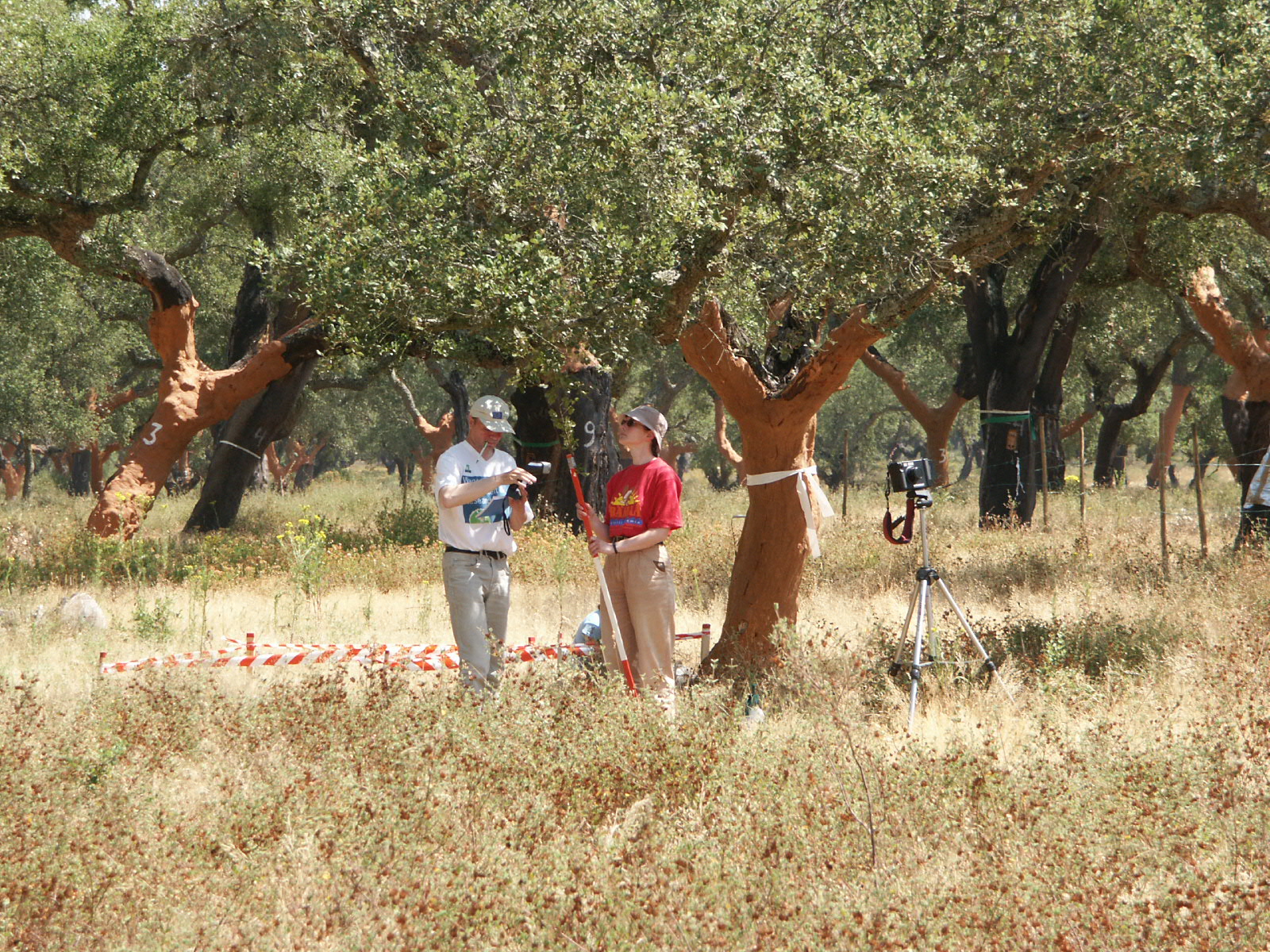
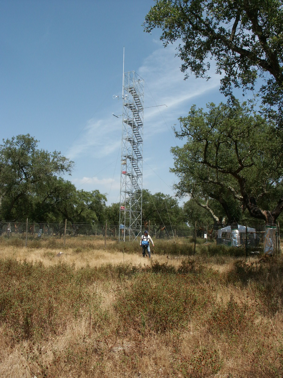
WP6 (FIELD) ESTABLISH INTEGRATED MULTIDISCIPLINARY
FIELD SITES IN
PORTUGAL AND ITALY
Objectives:
- Establishment of experimental sites and preparation for
multidisciplinary trials.
- Definition of experimental strategy for collaborative experiments.
Participants involved: UNPADUI,
ISA, IDRHa and COTR
Methodology:
The project aimed to provide
information relating to the
water management in water-limited regions of Europe. We therefore
considered it essential to obtain data for a range of contrasting
agricultural or
semi-natural agricultural ecosystems typical of these areas. We
therefore studied contrasting crops including: intensive orchards
(peach in Portugal),
and less intensive systems of olive (Italy) and montado (cork -
Portugal). These
cover a range of vegetation structures and also compare similar systems
in two different water-limited areas.
Sites have been chosen on the basis of extensive areas of relatively
homogeneous vegetation, ready availability of necessary infrastructural
support (field laboratories, power, access). Another important
criterion was the interest of the landowners, since an important
objective was the
transfer of technology developed to farmers and agencies of the region.
Initial
work has been done on the two orchard sites, with the more challenging,
olive/montado
site being set up from the second year.
All these situations present important challenges to many of the
presently available techniques for monitoring water use, due to their
generally discontinuous and often heterogenous nature. Fields have been
instrumented to gather basic meteorological information throughout most
of the project lifetime, in order to provide WP8 and WP9 with
continuous records of environmental inputs. These have included: air
temperature and humidity,
wind speed and direction, global solar radiation, soil temperature and
precipitation.
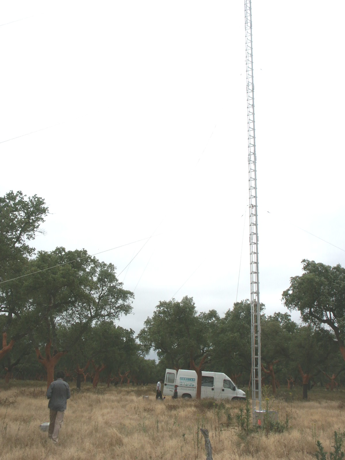
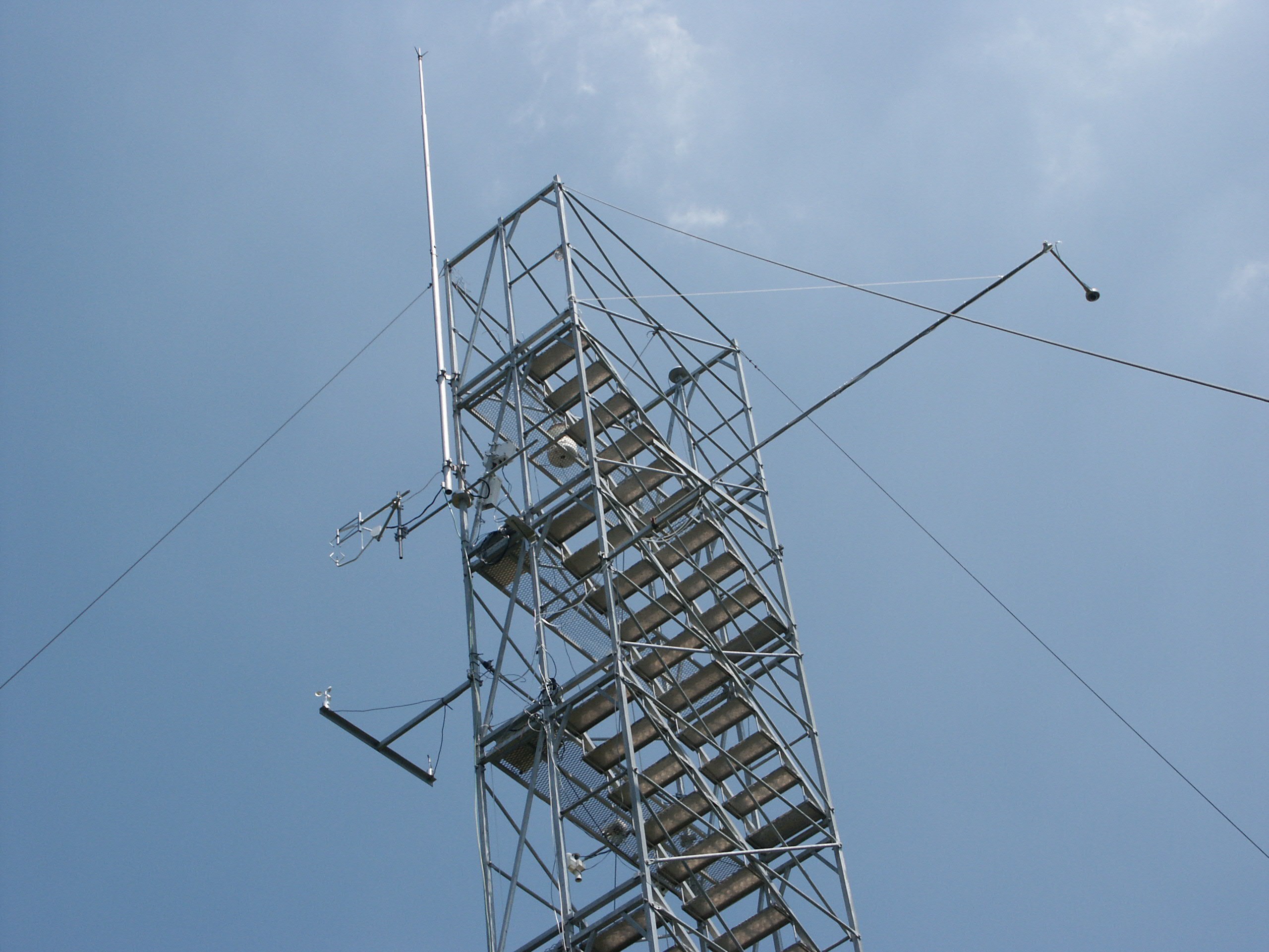
Towers of proper height have been installed to mount eddy covariance
instrumentation during the intensive observation periods (WP7).
Satellite images of the areas have been obtained over the period for
remote ET
estimation.
WP7 (LAND-WATERUSE) USE OF INTEGRATED MULTIDISCIPLINARY
FIELD TRIALS TO
STUDY/DESCRIBE PARTIONING OF WATER FLUXES IN HETEROGENEOUS AGRICULTURAL
AND SEMINATURAL LAND USE SYSTEMS
Objectives:
The underlying objective of the whole
project is to provide
information of use to water resource managers on water use by
heterogeneous land use systems. This integrating study therefore aims
to provide this key
information on physiological processes including diurnal and seasonal
dynamics of transpiration (sap flow rate) in relation to potential
transpiration
(estimated from potential evapotranspiration for experimental trees and
stands)
and their relationship to stand and environmental variables. Therefore
specific objectives of WP7 are:
- Field comparison of multiple techniques for measurement of water
use
- Provision of case-history data on water use in relation to land
use
and management as climatic factors
- Provision of comparative data on water balance of contrasting
types
of land use (orchard, forest) from viewpoint of tree and
waterrelations, level of drought stress and enlargement of tree
vitality and functional
stability.
Methodology:
This Workpackage brings together all
participants in the
central co-ordinated multidisciplinary series of experiments.
Measurement of energy/water budgets in discontinuous and/or
heterogeneous canopies is
an ambitious task which the project addressed at a range of scales
with different techniques both for technique intercomparison and for
quantification of fluxes in the case study systems. During Intensive
Observation
Periods (IOP), a full set of instruments has been deployed in the
fields
prepared in WP6.
All techniques developed in WPs 1-5 soil and flux measurement have been
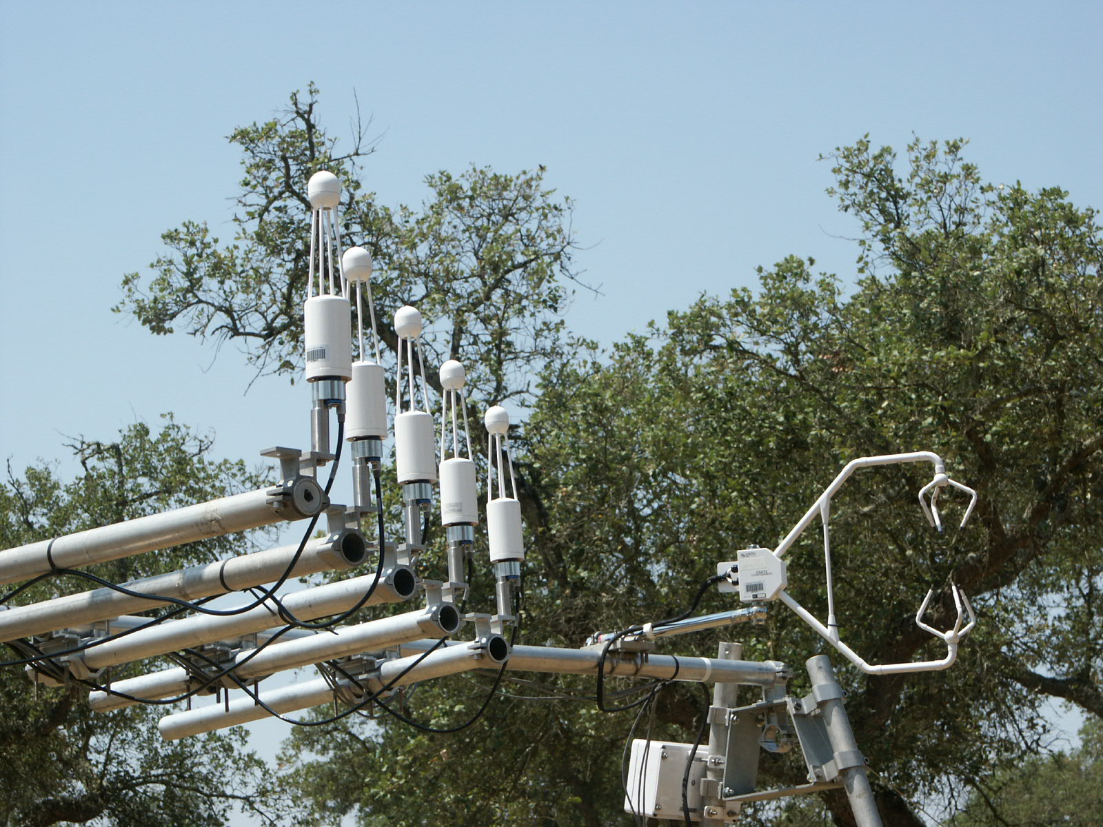
deployed. In addition to continuous standard meteorological data, other
instrumentation included Kipp&Z CNR1 net radiometers, with
particular attention to horizontal variability of radiative properties
of canopies
and energy fluxes, by positioning instruments at a proper height. Soil
heat
flux has been sampled at several locations to account for
heterogeneity.
Turbulent
fluxes of sensible and latent heat have been measured by eddy
covariance
technique, using triaxial sonic anemometers (Campbell CSAT3 and Gill
R3) and IR gas analyzers (LI-COR 6262 and 7500). Ancillary
micrometerological measurements included air temperature profiles
in the canopy layer
and above at 10-20 Hz, synchronous with turbulence data, in order to
assess aerodynamic coupling to the boundary layer. Bulk fluxes of
evapotranspiration
have been
split into transpiration from plants and evaporation from soil surface,
using measurements of whole-plant sap-flow transpiration data on the
whole
tree level for evaluation of conductance at the tree and stand levels.
Leaf
water potential, stomatal and boundary layer conductances (steady-state
porometers and heat balance of facsimile leaves - using infra-red) have
been addressd. These data has been used in WP8 to feed detailed,
multidimensional models of water flow in the SPA continuum.
WP8
(MODEL FRAMEWORK) DEVELOPMENT OF A FRAMEWORK FOR THE MODELLING OF WATER
FLUXES IN HETEROGENEOUS LANDSCAPES
Objectives:
- To evaluate different modelling approaches with respect to their
capabilities to predict the observed processes.
- To evaluate different scaling -up procedures with respect on the
spatial and temporal resolution of calculation as well as the
aggregation of input parameter.
Participants involved: ISA and
DIAAT-UNINA
Methodology:
An appropriate modeling approach for
the water use of complex agricultural and agroforestry systems in
water-limited areas of southern Europe needs to follow a consistent,
step by step, scaling-up
from simple process analyses procedure, to integrated areal analyses
over
large areas (usually catchments).
Therefore in this workpackage we have focused first on the
understanding
and modeling of key partial processes such as soil water movement, the
water uptake by the root systems, transpiration and the evaporation.
The
modeling of such process is yet far from being satisfactorily solved
for
ecosystems showing a significant spatial heterogeneity (horizontally
and
vertically) in the vegetation distribution. Water fluxes were
described using soil
water storage capacity models as well as models based on Richards
equation, which differentiate between different horizontal soil
layers on the basis of
soil and root distribution characteristics. Typical soil water
extraction and
redistribution patterns have been described. Possibilities of
simplified
modeling of ET
have also been evaluated and tested against datasets obtained in WP7.
Based on
results, experience and state of the art (literature) shortcomings have
been
defined.
In a second step up-scaling to establish the water
balance for a whole stand/orchard was involved. The database allows us
to
identify
adequate approaches to simulate the water fluxes without loosing
critical
hydrological information identified at the single tree level.
WP8 therefore provides information relevant to the practical
decisionmaking process in water resources management, contributing to
more rational decisions, and more predictable and economic means of
achieving. Input parameters had to be determined independently from
the dataset used for validation - here the parallel studies in Italy
and Portugal havel been
used. In addition part of the results were used for calibration and
a second
part served as reference during validation. The degree of
simplicity of the
used models in relation to the reliability and accuracy of the
forecasts
required were considered. Results allow the definition of
shortcomings in our
knowledge and the identification of critical functional relationships
to improve
prediction robustness.
WP9 (USERS) TRANSFER TECHNOLOGY TO USERS AND
PREPARATION OF REPORTS AND PUBLICATIONS
Objectives:
- Transfer of knowledge for different users.
- Documentation and summary of the different tasks and their
results
with preparation of adequate internal and external reports and
publications.
Participants involved: All
Methodology:
Technology transfer has been and will be through a range of methods
appropriate to
the information produced. These methods include:
- Arrange seminars to relevant agencies
- Preparation of a handbook summarizing conclusions of use to
growers and catchment managers
- It is likely that a number of the techniques developed in
this project will offer scope for wider commercialization,
so, where appropriate, steps will be taken to protect the inventions
and marketing and commercialization of instrumentation and software
will be pursued where appropriate.
- Sales partners for the commercialization of the new developed
technologies have been or will be acquired.
- All participants contributed to preparation progress
reports and the final report.
- In addition, to publicize the scientific developments
from the project to other interested scientists, results have been and
will be
presented at appropriate international conferences and an open workshop
on techniques for describing and quantifying water
flows and storage in heterogeneous vegetation has been organized.
- The scientific developments have also been and will be published
where possible
in the appropriate refereed international Journals.